Round leaved sundew {Drosera rotundifolia}, Westhay Nature Reserve (Somerset Wildlife Trust), Somerset Levels, Somerset, UK. June 2011. - Ross Hoddinott/2020VISION
Science, Evidence and Monitoring at Honeygar
Our commitment
Honeygar is a different approach for Somerset Wildlife Trust, taking a site that has a low baseline for biodiversity with a view to restoring ecosystem function rather than setting specific goal for habitat management. Instead of setting a site plan with scrapes, as we have done for other Levels reserves, we are focusing on restoring the peat and allowing the ecosystem to recover. We have a long-term plan for monitoring and using the evidence collected to inform whether further interventions are required.
We are committed to scientific rigour and evidence-based management on all our sites including Honeygar. In partnership with academic and research bodies, including the University of West England, an extensive monitoring programme has been established. This programme has focused on capturing a wide array of environmental data, from carbon flux and water quality metrics to detailed biodiversity surveys. This data not only informs the ongoing management of Honeygar but also contributes valuable insights into the efficacy of peat restoration techniques, and validation of innovative green finance standards, while offering guidance for similar projects both within the UK and globally.
Working with academics, universities and local specialists
Working with academics, universities and local specialists we now have an established baseline for biodiversity, soil types, water quality and for greenhouse gas emissions for Honeygar, which is essential for us to monitor the changes as we see our interventions begin to impact the site. We are already seeing a greater abundance and diversity of species showing that our management of Honeygar is benefitting nature even after just a few years.
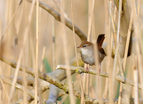
During 2023-24 we trialled four bioacoustics sensors provided by the developer Wilder Sensing. Over the year these have recorded a staggering 1.3 million bird-call records. As the habitats at Honeygar change as a result of our interventions and restoration works we will be able to track changes in species composition and behaviour. The data has already helped us identify the presence of night heron on site, and recognise a change in the habits of sparrows and dunnocks that are having their chicks earlier in the year likely due to climate change.
Green House Gas Monitoring Research
The depth of the water table—the level below which the ground is saturated with water—is a key determinant in the amount of carbon dioxide and methane released from peatlands. This factor is more significant than the surface use of the land.
Our findings so far at Honeygar are in line with national and international research demonstrating that holding the water level at optimum (30-10cm below surface level) on peatlands substantially reduces their carbon dioxide emissions and balances out increases in methane emissions. If the water table is at surface level the methane emissions increase.
As we continue to collect this data at Honeygar the insights enhance existing knowledge and understanding of lowland peatland management locally, nationally and internationally. It is particularly important to explore how variations in temperature and different types of vegetation affect methane production and overall carbon emissions.


