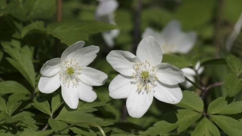
Wood Anemone - Wildstock
Location
Know before you go
Dogs
Visit the 'Dog walking on reserves' page in the Contact section for more information.
When to visit
Opening times
Open at all timesBest time to visit
April to JulyAbout the reserve
Quants lies on a steep north westerly facing slope of the Blackdown Hills. At several points on the reserve the Greensand Springline is exposed. Water seeps from the ground at these places making it very wet. Alder and Birch can thrive on this wetter ground as do Pendulous Sedge, Giant Horsetail, Shagnum moss and the tiny pink flowred Bog Pimprnel. Where the ground is drier Oak, Ash and Field Maple do well and these woodlands support a diverse flora.
In spring look out for Bluebell, Dog's Mercury, Sanicle, Wood Anemone, Wood Sorrel, Wild Strawberry, Sweet Woodruff and Early Dog-violet. In early Summer Common Spotted Orchids can be seen along woodland edges. The woodland supports a rich lichen flora and Quants is the only Somerset location at which Ochrolechia Inversa is known to occur.
In the south west of the reserve are areas of a neutral grassland. Crested Dog's-tail, and Red Fescue are the dominant grasses but Yorkshire Fog and Sweet Vernal-grass also occur. Herbs include Common Knapweed, Devil's-bit, Cowslip and Fleabane. Small areas of heathland and fen can be found in this same area. To date 30 species of resident breeding butterflies have been recorded here. Other insects found here include Hornets, and the rare Hoverfly Criorhina Asilica.
Reserve conservation management – Some summer grazing to maintain grassland. Woodland management involving thinning to ensure an open tree canopy enabling a healthy shrub and herb layer.
History and Archaeology - The Tithe Map from 1838 shows the reserve to have once been part of Blackdown Common. Enclosure during the late 1890’s produced the field boundaries that are still evident on the ground today. The 1891 and 1905 Ordnance Survey maps indicate that the area now occupied by the reserve consisted of rough pasture, heath, moor, furze and scattered woodland. Quants Farm, now only visible as minor ruins just to the north west of the reserve, appears to be the only farm in close proximity.
During the late 19th Century and early 20th Century a series of adits and underground pipework was constructed to collect and supply water for Taunton. Three adit entrances, two tunnel ventilators and a series of manholes remain within the reserve and are still part of the water supply infrastructure for Wessex Water.
The soils become more acid in the southern part of the site where Bracken is common. Small areas of heath occur here and these are dominated by Heather, Gorse and Western Gorse and you will also find Creeping Cinquefoil and Tormentil.The lichen Cladonia portentosa is also present here, this grows on the ground and is known as Reindeer lichen, as Reindeer do eat it.
Quants is also close to Castle Neroche, Butterfly Conservation’s Mount Fancy Farm and Little Breach reserves, Blackdown Hills AONB and NT Wellington Monument.


