Formation of healthy peatlands
Peatlands cover just 3% of the surface area of the earth but store almost a third of the worlds carbon. Formation of peat on the Somerset Levels and Moors began more than 7,000 years ago as previously underwater clay-lined valleys were colonised by reeds and other aquatic vegetation that over time only partially decayed and compacted by other growth in the swamps eventually forming peat.
Healthy peat has absorbed and stored greenhouse gases over the thousands of years as it forms, slowly, just 1cm per year. Deep peat is classed at 40cm or more. In Somerset we are lucky to have extensive areas of deep peat in places up to 3m in depth which store an estimated 11 million tonnes of thousands-year-old carbon. We estimate some 300,000 tonnes of CO2 equivalent are released each year from the peatlands of Somerset, 10% of the county’s total emissions.
To remain healthy peat needs a stable water level somewhere between 30cm and 10cm below surface level. Constant drying and rewetting causes the peat to degrade, as does draining it entirely.
Our aim in work on peatlands is to restore peat to a healthy state by holding a constant water level so that it can perform key functions including carbon storage, water management, maintain field levels and infrastructure, and provide vital and rare habitat for wildlife.
When peatlands are healthy they support a wide variety of wildlife not found in other habitats but people often mistake peatlands thinking they should be wooded for example. These special places are home to a wide range of species, from dragonflies and damselflies, to wading curlew and snipe; from carnivorous plants to flitting butterflies.
Damaging processes and current issues
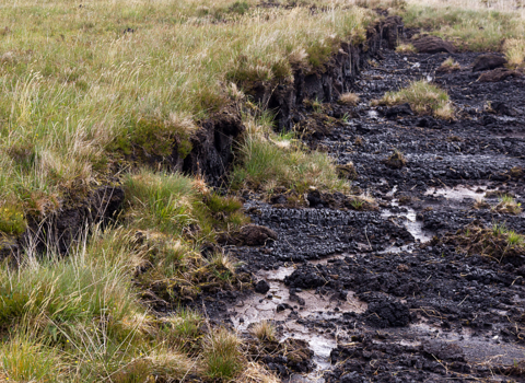
When saturated peat soils are drained, e.g. to permit agricultural use, a series of events are set in motion, namely peat shrinkage and the oxidation (decomposition) of previously water-saturated organic material under aerobic conditions. These processes result in carbon emissions to the atmosphere, a reduction in peat volume, and lowering (subsidence) of the land surface, which can reduce by up to 2cm per year.
Drained peat that is degrading loses its spongy consistency and is unable to store water effectively so rain passes straight through into the landscape instead of being stored, increasing water flows.
Periodic shrinkage of peat (with some swelling due to winter rewetting) results in shrinkage and slumping across a landscape that impacts on a whole range of infrastructure across the levels. Anyone driving along the roads can notice the sometimes massive bumps, with further impacts on deformed bunds, embankments and drains.
Keep up to date with our work across the county
Sign up below to receive the latest news from Somerset Wildlife Trust, learn about great events near you and learn how you can help wildlife in your local area.


