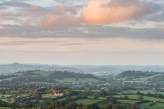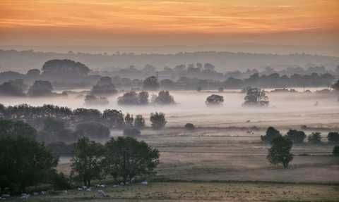
Sunrise over Earlake Moor from Burrow Mump, Somerset Levels, Guy Edwardes/2020VISION
Adapting the Levels Landscape Recovery Project
What is the project all about?
Adapting the Levels is a partnership project dedicated to bringing together and supporting those who live and work in parts of the Brue Valley on the Somerset Levels.
As one of Defra's first pioneering Landscape Recovery projects in England, Adapting the Levels aims to facilitate the delivery of landscape-scale environmental and social benefits. Ultimately, the project will develop a suite of adaptation options to plot a course through the challenges of climate change and economic uncertainty.
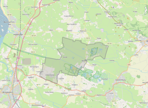
Adapting the Levels project area
Adapting the Levels project area
The project area covers over 5,000 hectares and sits within the River Brue catchment, between Burnham-on-Sea and Glastonbury. 15 landowners have signed up for the project, which equates to a total of just over 1,000 hectares of land. Most of the project outcomes will occur within these geographic boundaries, however there is also scope to work with communities in the surrounding area.
Sustainable food systems are underpinned by a healthy environment and thriving wildlifeThe Wildlife Trusts
A collaborative approach
Under this project, landowners, farmers and DEFRA are working together with the Somerset Wildlife Trust to explore how working with nature can bring a variety of benefits, including protecting peat resources to reduce carbon emissions, improving water quality and adapting to climate change. The project is also looking at developing sustainable green finance mechanisms to support landowners and communities in making long-term changes.
Heritage
The Somerset Levels and Moors are rich with history, from Neolithic walkways over the marshes, to Roman salt works and iron age villages, and the Adapting the Levels Project Area is no different. It is due to the waterlogged nature of the peat and clay soils that these historical artefacts remain in a high level of preservation. However, the drained nature of the area is now putting these artefacts at risk. The Adapting the Levels project is working closely with Historic England and The South West Heritage Trust to ensure that interventions, such as raising the water table, not only protects the peat, but also works to preserve and enhance the unique historic environment.
Community Engagement
The community living in the project area plays a vital role. People’s voices and visions for a restored landscape will help shape the overall strategy and contribute towards a more connected landscape and a thriving community that is resilient to climate change and economic uncertainty.
If you have any questions about the project, or would like to find out ways to get involved, please contact Thibaud Sulzer, Nature Recovery Community Engagement Officer by emailing thibaud.sulzer@somersetwildlife.org
Look out for updates and upcoming events below that will provide further information on how to get involved.
